


 Children 0-16
 Youth 17-24
 Students
 Accessibility
 Luggage
 Animals
 Disruptions
 Tram
Tram
Pirkkala 2028
The tram overhauls public transit
Public transportation in Pirkkala will undergo significant changes when tram line 3 begins operating from Sorin aukio to Partola. With the introduction of the tram, the bus route network will be reorganized to support smooth connections throughout Pirkkala and towards Tampere.
Access to services, workplaces, and educational institutions will improve. In particular, travel to Suupa, Partola, and Peltolammi will become easier.
In the future, most trips to the Tampere city centre will go through Partola. In addition to transfer connections, the plan includes a direct bus route from Suupa to Tampere via the ring road.
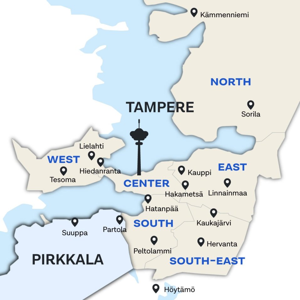
Areas in Pirkkala: Haikka, Huovi, Killo, Kurikka, Kyösti, Lentokenttä, Linnakallio, Linnakorpi, Loukonlahti, Naistenmatka, Niemenmaa, Nuoliala, Pakkalankulma, Partola, Pere, Pirkkalankylä, Sankila, Suuppa, Takamaa, Toivio, Turri, Vaitti, Vähäjärvi
Tram and feeder routes in Partola
Partola – Härmälänranta – Härmälä – Rantaperkiö – Arboretum – Hatanpää – Viinikanlahti – Sorin aukio – Koskipuisto – Rautatieasema – Tulli – Sammonaukio – Kaleva – Uintikeskus – Kalevanrinne – Hakametsä – Turtola – Hallila – Opiskelija – Hervantakeskus – Hervannan kampus – Etelä-Hervanta – Hervantajärvi
Turri – Kyösti – Solja – Niemenmaa – Suuppa – Rantaniitty – Haikka – Loukonlahti – Killo – Nuoliala - Pakkalankulma – Partola
Turrintie - Soukanlahdenkaari - Naistenmatkantie - Lentoasemantie - Suupantie - Naistenmatkantie - Lestipolku - Lestipolku - Kenkätie
Itineraries and route numbers are preliminary and may change during the further planning of the 2028 Route Network. Final decisions will be made as the planning process progresses in autumn 2026.
Killo - Nuoliala - Pere - Partola
(Niittykulmantie -) Killontorintie - Naistenmatkantie - Pereentie - Nuolialantie - Kenkätie
Itineraries and route numbers are preliminary and may change during the further planning of the 2028 Route Network. Final decisions will be made as the planning process progresses in autumn 2026.
Huovi – Takamaa – Vähäjärvi – Suuppa – Rantaniitty – Kurikka – Linnakorpi – Partola
Lentoasemantie - Takamaantie - Ollikantie - Lentoasemantie - Suupantie - Naistenmatkantie - Kurikantie - Linnakalliontie - Kenkätie
Itineraries and route numbers are preliminary and may change during the further planning of the 2028 Route Network. Final decisions will be made as the planning process progresses in autumn 2026.
Partola – Toivio – Sarankulma – Palokallio – Peltolammi – Lahdesjärvi – TAKK Nirva
Kenkätie - Palmrothintie - Ruotutie - Ojatie - Patamäenkatu - Rukkamäentie - Lempääläntie - Eteläinen Lempääläntie - Autovarikonkatu - Automiehenkatu - Vuoreksen puistokatu - Kurssikeskuksenkatu
Itineraries and route numbers are preliminary and may change during the further planning of the 2028 Route Network. Final decisions will be made as the planning process progresses in autumn 2026.
Partola – Messukeskus – Rautaharkko – Taatala – Koivistonkylä – Korkinmäki – Hallila – Pohjois-Hervanta – Hervantakeskus – Hermia – Lintuhytti
Kenkätie - Saapastie - Ilmailunkatu - Sarankulmankatu - Lahdenperänkatu - Lempääläntie - Koivistontie - Hallilantie - Loukkaankatu - Pehkusuonkatu - Lehtimäenkatu - Havumetsänkatu - Hervannan valtaväylä - Kanjoninkatu - Ruovedenkatu - Opiskelijankatu - Insinöörinkatu - Teekkarinkatu - Hervannan valtaväylä - Hermiankatu - Hervannantie - Ruskonkehä - Lintuhytinkatu
Itineraries and route numbers are preliminary and may change during the further planning of the 2028 Route Network. Final decisions will be made as the planning process progresses in autumn 2026.
Other bus routes in Pirkkala
Pirkkala – Niemenmaa – Solja – Turri/Kyösti – Turkkirata – Vaitti – Linnakallio – Viinikka – Linja-autoasema
Suupantie - Lentoasemantie - Naistenmatkantie - Turkkirata - Teollisuustie - Jasperintie - Kurikantie - Tampereen läntinen kehätie - Valtatie 3 - Lempääläntie - Tampereen valtatie - Vuolteenkatu
Itineraries and route numbers are preliminary and may change during the further planning of the 2028 Route Network. Final decisions will be made as the planning process progresses in autumn 2026.
Tredu Pirkkala – Vaitti – Huovi – Pirkkala – Solja – Turri/Kyösti – Pitkäniemi – Villilä – Ala-Rahola – Piikahaka – Raholanharju – Tesoma – Ikuri – Myllypuro – Kolmenkulma
Myötätuuli – Tornikaari – Lentoasemantie – Suupantie – Naistenmatkantie – Anian Rantatie – Rajasalmentie – Pitkäniementie – Rajasalmentie – Sarpatintie – Nokiantie – Tesoma valtatie – Tesomankatu – Kolmihaarankatu – Pihtisulunkatu – Kolmihaarankatu – Rounionkatu – Kolmenkulmantie
Itineraries and route numbers are preliminary and may change during the further planning of the 2028 Route Network. Final decisions will be made as the planning process progresses in autumn 2026.
Höökinmäki – Äijälä – Hongisto – Pirkkalankylä – Sankila – Sionkylä – Sorkkala – Vaitti – Huovi – Suuppa – Kyösti – Turri – Sankila
Äijälä - Anian rantatie - Sorkkalantie - Lentoasemantie - Suupantie - Naistenmatkantie - Anian rantatie - Sankila
Trams form the backbone of public transportation
Tram connections between Sorin aukio and Partola replace a substantial part of present bus service running the same route. Because of this, a large portion of current direct bus routes will change to feeder routes to the tram in Partola.
The overhaul will result in more frequent intervals, better connections between areas, and smoother travel routes both within Pirkkala and when traveling between Tampere and Pirkkala.
Service levels inform route development
Public transit is developed according to different transportation needs. Planning is informed by service level objectives, which establish, for example, how often buses run in an area.
Linjasto 2028 -suunnitelmassa joukkoliikenteen palvelu paranee monilla alueilla. Pysäkki voi olla hieman nykyistä kauempana, mutta yleensä kävelymatka pysäkille on enintään 600 metriä (alle 10 minuuttia).
Under the Route network 2028 plan, public transit service improve in many areas. A stop may be located a wee bit farther away than it is now, but generally the walking distance to a stop will be no more than 600 meters (less than 10 minutes).
 More information